


What does BeiDou satellite study tell us about trains in China?
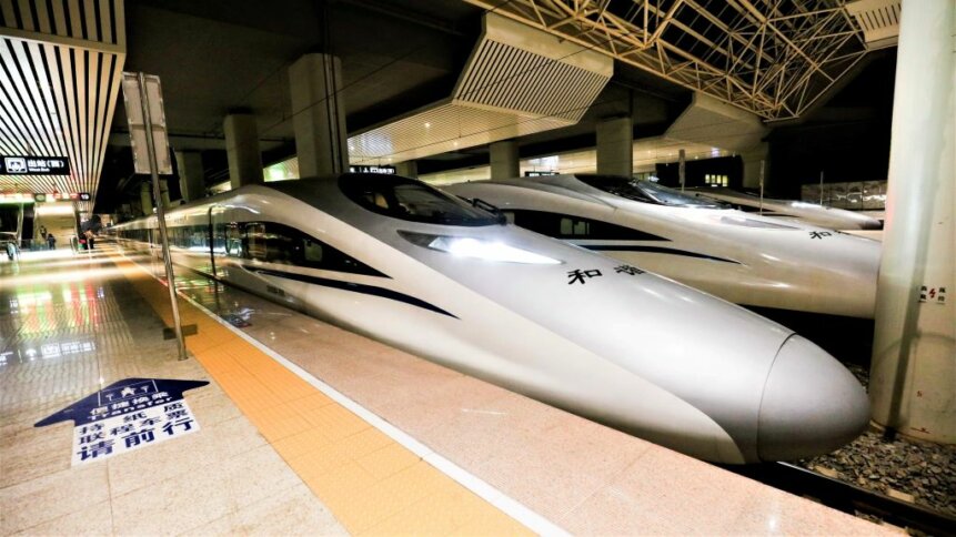
Ground-breaking train tech: China has wowed the world with its expansion in high-speed rail. And the breakthroughs could keep coming, such as bringing BeiDou Navigation Satellite System (BDS) perception to trains in China. Image credit: humphery / Shutterstock.com.
Trains in China have been transformed in recent years as the country has embraced high-speed rail and expanded its network to more than 40,000 km of tracks. The country has more high-speed rail than the rest of the world combined, but the breakthroughs don’t stop there. A study published in the launch issue of the journal High-Speed Railway shows how satellite-based train state perception – for example, using China’s BeiDou Navigation Satellite System (BDS) could revolutionize railway signaling.
How does train signaling work?
To understand the benefits of using satellite navigation methods to keep track of trains, it’s useful to consider how railway signaling works today. The governing principle of railway signaling is that no two trains should occupy the same portion of the track. And there are two approaches to managing train movements – fixed block and moving block signaling.
In both cases, the block length (the portion of track reserved for each train) is defined by the stopping distance of the fastest service using that line. And keep in mind that trains in China can take kilometers to come to a standstill when traveling at high speeds.
Fixed block signaling systems only allow trains to proceed when the next block has become vacant, whereas moving block approaches make sure, dynamically, that there’s sufficient space ahead and behind to accommodate the braking of all units on the line.
Today, the amount of trackside equipment has grown to provide not just signaling data, but also includes systems to monitor train integrity – in other words, whether the front and the back are still attached. There’s other kit too, such as railway infrared hot box detectors that can determine whether wheel bearings are overheating and stop trains before mechanical failures occur.
A #Fuxing #bullettrain, with a designed speed of 350 km/h, departed on Tuesday morning from the Southwest Chinese city of #Guiyang, marking the operation of the Guiyang-Libo section of the Guiyang-Nanning High-speed #Railway. @VisitGuiyang https://t.co/XUSMHTOEiH
— Enterprising China (@sinoprise) August 9, 2023
Key to the implementation of today’s railway management systems is the placement of so-called balises (pronounced /ba-leases/ and named after the French word for ‘marker’), which stand proud a couple of inches above the sleeper below. If you’ve traveled on trains in China and elsewhere in the world, you’ll likely have seen the yellow- or orange-colored units in between the rails.
In their simplest state, balises are kind of like contactless payment points for trains. But rather than record transactions, these track-located transponders – which are powered by looms underneath the locomotive – provide information to the train on its whereabouts and details on the upcoming section of track.
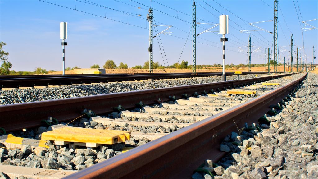
Train transponders: Balises standing proud on a section of track in Europe.
For example, while the train keeps track of its location by counting wheel rotations, this calculation can be checked against the ground truth telegraphed by each balise. This is necessary as wheels slip and wear causes a reduction in diameter that would – if left unchecked – underestimate the distance traveled on long journeys.

In addition, the beacons tell the train its permitted speed limit for that block of track, as well as information on the geometry and gradient of the upcoming section. Also, balises placed in sequence inform the train of its direction of travel.
However, there are cost implications of having to install and maintain infrastructure over thousands of kilometers of tracks. And to reduce the quantity and complexity of the track-side equipment that’s involved in supporting a modern railway, such as trains running in China and on high-speed networks in other countries, operators are considering approaches that are increasingly train-centric.
In their study, the researchers based at Beijing Jiaotong and Wuhan Universities – with expertise in computer and information technology, and Global Navigation Satellite System (GNSS) approaches – consider the idea of so-called virtual balises.
Trains in China
Leveraging satellite positioning data gathered from BDS, which was constructed to provide independence from GPS, trains in China receive balise information based on their location. The advantage, as the Beijing and Wuhan teams point out, is that existing train control system frameworks could remain the same, as the information formats, etc, would be unchanged. But you could reduce the amount of physical trackside infrastructure that’s required.
Satellite positioning data could also be used for train integrity monitoring, to ensure that the front and back of the formation are where you’d expect them to be. And, based on field tests, the teams conclude that satellite systems could be key technologies in raising the capabilities of train-borne navigation.
Also, trains in China are by no means the only modes of transport to jump on this trend. Buses, trams, and trains elsewhere can be seen fitted with rooftop antennas that have active GPS/GNSS capabilities. But what’s striking about the development of intelligent high-speed rail in China is how it’s competing with short-haul flights, and – by all accounts – winning that competition.
And more trains and fewer flights is important to curb carbon dioxide emissions associated with transportation. On TechHQ we’ve written about the steps that aircraft manufacturers and operators will need to take to make aviation more sustainable. And those plans are based on continued growth in demand for flights, but China is showing that high-speed trains can reduce the environmental impact of aviation – at least when routes are competitive with short-haul flights.
High-speed trains in China can carry hundreds of passengers at a time, sometimes even more. The extra-long version of the Fuxing Hao Series Bullet Train can reportedly accommodate 1,283 passengers in 17 cars. And, if the concept of virtual balises takes off, satellite positioning could reduce the cost of operations and add to the appeal of high-speed rail.

16 August 2023

16 August 2023

15 August 2023